
A former trading hub, the city has preserved some of the architectural treasures inherited from its glorious past.
Japan is famed for its many beautiful places. However, most of its cities and towns have been ravaged by wars, natural disasters and urban development. You only need to walk around Tokyo, Osaka or Nagoya to realise that precious few of their old cityscapes have survived to this day. Even in Kyoto, its admittedly many architectural treasures are surrounded by a sea of ferro-concrete.
Though Edo, Tokyo’s older, feudal version, has all but disappeared, we can get an idea of what it looked like by visiting a few places not far from Japan’s capital. These towns are collectively called Koedo (Little Edo) because they have deep ties with the former shogunate (military government) capital of the Tokugawa regime and have managed to preserve an old townscape that retains the atmosphere of Edo. One such place is Sawara, now part of Katori City, in Chiba Prefecture. Located on the banks of the Tone River, Japan’s second longest river, this so-called “water village” used to be a vibrant merchant town with its own sakebrewing industry and close commercial connections with Edo.
The Tone was once known as an uncontrollable river prone to floods. Originally, it flowed into Tokyo Bay along the course of the current Edo River. However, in order to control the flooding and develop water transport, largescale construction began in the 17th century – when the Kanto region became the political centre of Japan – and the course of the Tone was changed significantly as it was redirected eastward. Today, its vast watershed is therefore largely man-made.
It was during the Edo period (1603-1868) that Sawara began to prosper as a trading centre along the Ono River (a tributary of the Tone) when boat transport flourished, and many berths called dashi were built to unload goods from boats. It continued to prosper for some time after the Meiji period (1868-1912) and by around 1955, when automobile traffic began to develop, Sawara had become a town with an extensive commercial area.
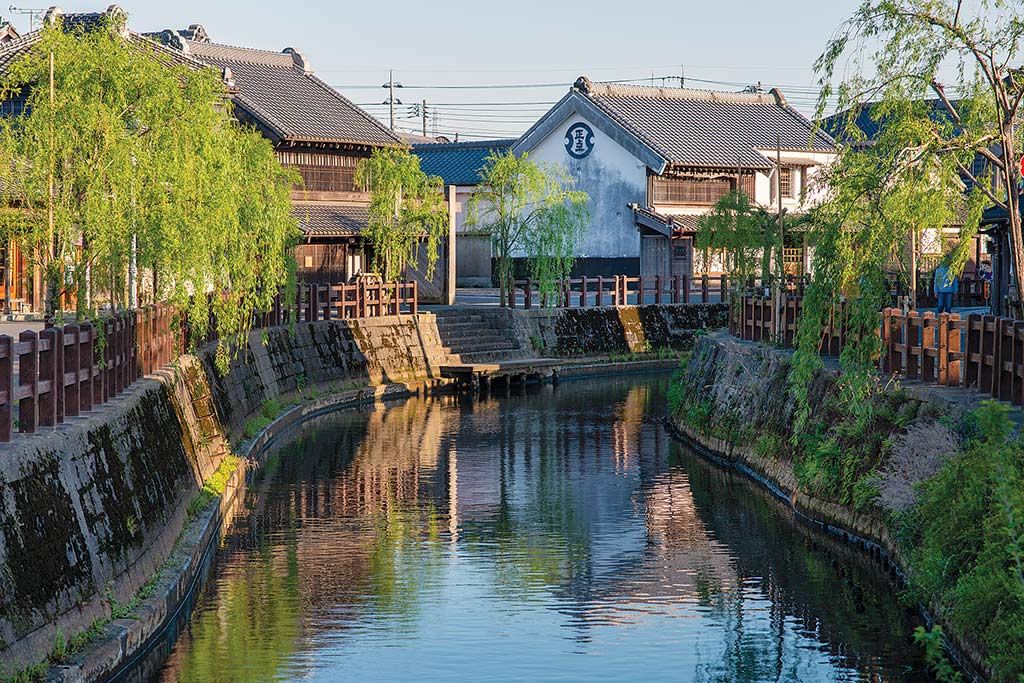
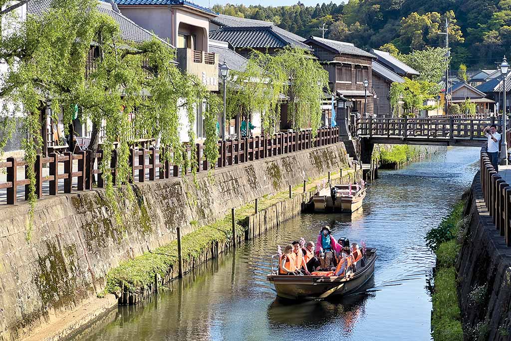
Even today, the Ono River flows from south to north in the middle of the town and is surrounded on both sides by old, densely packed buildings. In 1996, this 7.1 hectare area along the river was selected as the first Important Preservation District for Groups of Traditional Buildings in the Kanto region. Historic buildings were repaired, landscape maintenance work was carried out and most of the electric wires along the river were buried underground to preserve the old-time atmosphere.
The streets of Sawara are lined with wooden townhouses, kurazukuri (storehouses), and Western-style buildings built from the end of the Edo period to the early Showa period (1926- 1989) when Sawara was at its most prosperous. Its position as a commercial city along the Ono River is said to have been established during the period of the Northern and Southern Courts (1336-1392) at the latest. It is believed that the territory where Sawara is located was originally barren land formed by the sedimentation of a sandbar formed between the river and the Katori Sea.
In 1388, a market and several inns were established. At first, the area’s development was centred on the east side of the river, but by the time the Edo period began, it had expanded to the west side. From this period, the east side was called Honjuku and the west side Shinjuku. When the Tone River Eastward Transfer Project was completed and the Ono River was connected to the Tone, a route was established for goods from the Tohoku region and other regions to reach Edo via the Tone, and Sawara became a hub for ship transport. Later, the town also became a strategic point for land transport, with roads leading to Choshi and Narita.
Sawara was most prosperous from the late Edo period to the Meiji period. A regular and bustling market was held in Shinjuku, and the soy sauce and sake brewing industries flourished. In the middle of the Edo period, for instance, Sawara boasted 35 sake breweries. When the railway reached Sawara in 1898, the transport of goods to Tokyo by boat declined. However, thanks to the railway, the town continued to prosper. According to the 1920 census, Sawara had a population of 15,299, which was the second largest in Chiba Prefecture after Choshi.
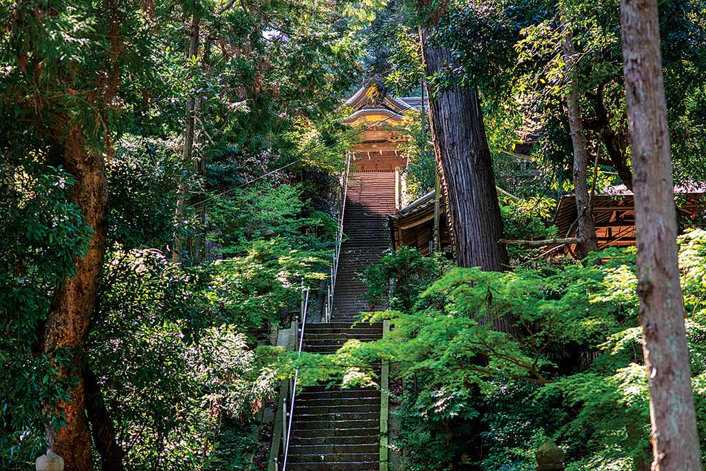
Our walk starts from Suwa Shrine, a short ten-minute walk from Sawara Station. You will recognise the site from the big torii gate near the street, but the shrine itself is located at the top of a beautiful steep stone stairway surrounded by trees. Clear spring water from the top of the hill flows through the side of the shrine into the pond next to the shrine office and further down into the Meiryu Falls. A dragon curled around a sword is enshrined in the basin of the waterfall. The current building was erected in 1853.
After following the road behind the shrine down the hill, we reach Tokun Shuzo, one of the area’s sake breweries. In the early Edo period (1661 to 1673), Ino Saburoemon bought a stock of almost 20,000 litres of sake from a brewer in nearby Ibaraki Prefecture and began sake production. In the mid-Edo period, there were 35 breweries in the village and Sawara became known as “Kanto’s Nada”, referring to the area around Kobe that was known as Japan’s sake mecca.
The founder of the Tokun Shuzo is said to have been apprenticed to the Ino family and learned all about the sake trade from them. He established his company in 1825 and, taking advantage of Sawara’s ideal location, including convenient ship transport along the Tone River and early yields of quality rice, his family has proudly carried on the history and tradition of sake brewing for nearly two centuries. Currently, Tokun and Baba Honten Brewery, both located along the same street, are the only two remaining breweries in Sawara.
We finally arrive at the Ono River and the heart of Sawara. Along the Ono River many historic buildings and shops housed rice wholesalers and brewers. Willow trees have been planted along the road and a surviving stone step (one of the aforementioned dashi), which was used to lift luggage and goods from the river, has been restored.
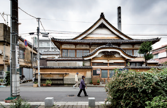
One of the things that set Sawara apart from similar places is its mix of buildings from such a wide range of eras, from the Edo period (mainly earthen storehouses) to the Meiji era (e.g. Shobundo), the Taisho era (Mitsubishi-kan) and the Showa era. However, after an extensive fire in 1892, which destroyed or damaged most of the area, the majority of the existing structures had to be rebuilt. Today, many of them are equipped with fire extinguishing systems.
Sawara’s old-time neighbourhood is also notable as a “living townscape” because many of the shops are still open. Some of them sell the same goods they used to sell centuries ago, while others have changed their merchandise. One such example is Shobundo, a bookstore that was first opened in the Edo period. The current building was erected in 1880 but the shop now sells Japanese sweets.
Another reason why the buildings have been preserved despite Sawara’s diminished importance as a trading hub is that they are still being used as dwellings. In fact, the population in this area did not decrease significantly for some time, even after commercial activity declined. It is thought that this was also influenced by the fact that companies associated with nearby Narita Airport and the Kashima Rinkai Industrial Zone were built near Sawara, allowing some residents to continue to live there while commuting to work.
The number of souvenir shops has increased in recent years, due to Sawara’s popularity with tourists, leading some people to point out that the town has lost some of its character. You can also see abandoned buildings and shops that have become residential houses. Since 1989, the population of the downtown area of Sawara has continued to decline and there are also issues related to building maintenance and inheritance.
As a solution to the problem of vacant houses, some of the buildings have been given to people planning to start new businesses. In this respect, the local authorities have been very active in repairing abandoned buildings and promoting regional revitalisation. The Katori City Sawara District Historical Landscape Ordinance, for example, has divided the area into two categories: “preservation districts for traditional buildings” and “landscape formation districts”. In addition, subsidies were provided to repair the buildings.
In order to protect the urban landscape when renovating buildings, certain regulations have been established, including that they should not be more than three storeys high and that their structure should be based on traditional architectural styles. However, the standards for construction methods and materials are not enforced. Also, since there are no restrictions on the residential part at the back of the buildings, there have been many cases where they have been renovated in a modern style.
One of the buildings facing the Ono River is the former residence of Ino Tadataka, the surveyor and cartographer who is known for completing the first map of Japan using modern surveying techniques. As we saw earlier, the Inos were one of Sawara’s major brewers (they actually engaged in a wide range of businesses, including rice, oil, and shipping). Tadataka was adopted by the Inos when he was 17 and lived in this house for 32 years. After becoming the head of the household he ran the family business, expanding its sake brewing and rice-trading concern, until he retired at the age of 49. Then he moved to Edo and became a pupil of astronomer Takahashi Yoshitoki, from whom he learned Western astronomy,geography and mathematics. From the age of 55, he was asked by the government to survey Hokkaido and then the rest of the country as well. He made ten surveying trips over a total of 3,736 days, travelling 40,000 kilometres – equivalent to circling the Earth – until the age of 71. The store and main building in Sawara that we can visit today were designated as national historic sites in 1930.
Only two minutes on foot but 300 years of architectural history separate the Ino residence from another notable building with a distinct character and a striking appearance: the former Sawara branch of the Mitsubishi Bank. Completed in 1914 at the start of the Taisho era, the Mitsubishi-kan inherits the Western brick building style of the Meiji period that reminds us of a past Neo-Renaissance influence. Inside, the atrium has been preserved and features a counter, a marble fireplace in the centre of the back wall and a spiral staircase leading to the second floor.
This structure was due to be demolished, but a group of local volunteers appealed for it to be preserved. As a result, Mitsubishi Bank decided to donate the building to the city. The NPO Ono River and Sawara Townscape Thinking Group was launched, and with the Mitsubishi-kan as its base, it began to provide tourist information focusing on activities for the preservation and regeneration of the old townscape.
Though interesting architecture can be found everywhere around Sawara, the best is concentrated between two bridges – the Chukei-bashi and the Toyo-hashi. The first one used to be called O-hashi during the Edo period, when it was made of wood. However, it burned down in 1722 and has since been rebuilt several times. In 1822, it was replaced with a magnificent stone bridge. Then, in 1957, it was widened due to an increase in the volume of traffic and finally, in 1968, the stone bridge was demolished and replaced with the current concrete bridge. Its present name, Chukei, is Tadataka (Ino’s first name) pronounced differently.
The other bridge, Toyo-hashi, spans the Ono River in front of Tadataka’s former residence. It was originally a large canal built in the early Edo period to carry water from the eastern part of town to the rice paddies on the other side of the river. Even after it became a concrete bridge before WWII, water continued to flow through a large water pipe under the bridge. When the water flowed into the Ono River, it made a sound (ja ja in Japanese) that gave the bridge its nickname. Today, the “Ja Ja Bridge is mainly a tourist attraction. Water flows from it every 30 minutes from 9:00 to 17:00. The sound of water flowing from this bridge has been selected as one of the 100 Soundscapes of Japan.
A stroll along the Ono River is a quiet and pleasant experience. Besides the willows, the river banks are decorated with weeping cherry trees, hydrangeas, cosmos and irises. The Ono is also home to many types of fish including carp, eels, black bass, channel catfish, and salmon in winter. Apart from the season when flowers are blooming, a good time to visit this area is during the Sawara Grand Festival. This matsuri (actually two distinct events: the Honjuku Gion Festival in July and the Shinjuku Autumn Festival in October) is somewhat reminiscent of the Edo period. One of the three major festivals in the Kanto region along with the Kawagoe Hikawa Festival and the Hitachi-no-kuni Sosha-gu Festival, it was registered as a UNESCO World Intangible Cultural Heritage in December 2016 and is the occasion for showcasing the town’s gorgeous floats.
Gianni Simone
How to get there
Leaving form Tokyo Station, take the JR Sobu line to Narita Station, then change to the JR Narita line to Sawara Station (around 35 minutes). Or catch an express bus from Tokyo Station to Sawara. The bus leaves from the Yaesu exit and the journey takes around 90 minutes.

